What Went Before: So, I’m kinda tired, which I attribute to having been woken up and terrified before the day properly began. The heart monitor is all wrapped up with a note detailing its slide into insanity and ready to be dropped off at the UPS store. I’ve written a note to my cardiologist on the portal, explaining what happened. I’ve done some ASL homework, and some writing, by which I mean thinking and also writing 750-ish new words, bringing the total words thus far to +/-21,260.
I’m done for the day. I may monkey a bit with Steve’s Chromebook, but it will be from the corner of the sofa, and under my comfy blanket.
Sunday. Cloudy and cold, but not precipitating. We are now under a Severe Weather Alert, but the probable accumulation of snow has been scaled back to 2 inches. There’s still ice in the forecast, and ice must never be discounted, but the accumulations there, too, have been reduced.
Woke to find two turkeys making an inspection of The Long Back Yard. It’s been years since I’ve seen turkeys in the yard. . . . and I’ve been living here long enough now that I can say years . . .
Breakfast was three little leftover Chinese sweet potato piergoies, with sour cream, and an orange. Finishing up my first mug of tea. Lunch will be leftover drunken noodles (yes, again).
My plans for the day are to perform my duty to the cats, study ASL, and write new words. Also on the list was getting the kitchen trash bagged up and into the garage before the weather started, but that’s been done.
So WAZE. You tell it where you want to go and it decides on the best way and that’s it? There’s no negotiation, other than the really broad AVOID TOLL ROADS and such like? Because while I will happily take 295 out of Maine, I am allergic to taking 95 around Boston, and would rather head west on smaller roads to gain my overnight in Cooperstown. I know this can be done because I have done it, but ship and pilot had a navigator then, and I do not have the route in my head. There was a reason Steve was our navigator. For instance, I know I can get out of Maine via Routes 2 and 4 and pay my respects to Mount Washington, as I did on my trip to Vermont, but I’m not at all certain of my routes beyond.
At this rate I may have to buy a road atlas.
The generator has just come on for its weekly systems check, and my mug is empty.
Whatcha all doin’ today?
Update: It’s begun snowing
Today’s blog title brought to you by Gaelic Storm, “I’ll tell me ma”
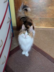
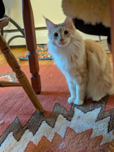
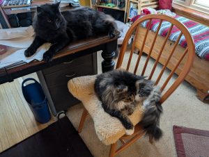
Sunday morning census below:


Yesterday, for the first time somehow, I ran into a cat adoption event at the local pet chain. While it’s true I don’t *always* shop on Saturdays, still, you would think that in the 2 years I’ve been going to this store, that one of my Saturdays would have coincided with one of their every-others. Anyway, I came so very close to walking out with an adoptee, especially when I heard that I could take her home for a week to see whether we all (me and my 2 cats of over 10 years) could learn to live together. In my current living quarters, space for another cat would not be a problem. But since I have been informed of a plan to move me into a much smaller space, much closer to the rest of my family, I resisted—barely, by the hair of my chinny-chin-chin. WAZE drives me nuts. I cannot read it, because I use distance glasses in the car. But also, often I cannot understand it when it tells me the name of the road to turn on next. The voice doesn’t necessary use clear enunciation, or it places the stress on the wrong syllable (or tries to equalize it across all syllables) and so I do not know what it says beyond “turn left” or “turn right,” and then I’ll be distracted and realize I’ve forgotten even that basic bit of info! I’ve become less comfortable with freeway driving, and so mine is set to avoid freeways and difficult intersections.
I buy a new road atlas every 5 years, just because it was the Proper Thing To Do, according to my father. One consulted with the Atlas for at least a week prior to travel for route planning, transcribing the relevant steps/labels to THREE copies of instructions (one for driver, one for navigator, last because navigator WILL manage to leave the house w/o it). Atlas will also be kept in the vehicle, for any surprise route deviations due to accident/construction/etc, as well as for disciplinary purposes, consistent with its sturdy construction. Atlas is exemplary for corrective thwapping of offspring, as it is capable of stinging w/o bruising and looks intimidating when brandished by the enraged driver.
I’m not comfortable with the new ways of navigation (wayz, Android auto, google etc, etc, etc.) but this does not stop me from trying. Right now I enter where I want to go and then take the suggested trip out for “study”. I then look at all of the places I don’t want to drive that its suggesting and break down my trip. Suggesting nicely that I want a route between specific smaller smaller places/towns that I pick. etc. Once I have the driving bits I feel more comfortable with (acknowledge I’m ok with adding a little bit of time and distance into the equations to keep my ugg factor down) I will then ask the navigation wizard to navigate me on a multi place route including the places I have worked out. Normally the nav wizard will changed the route slightly overall but provides a more calm (to me) route. A weird mix of old and new. Then because I’m old school. I still have a map in the car so I can sit and get the lay of the land if modern tech should fail. It may not be needed but its the stuffed toy that makes me feel better. As you know some of the routes you want you can play with some of the smaller sections?
In terms of routes, you could avoid all but a mile or two of I-95 in Massachusetts by taking I-495 to the Mass Pike and heading west from there (or cut a further corner by getting off I-495 at I-290 and going through Worcester before getting to the Pike). It’s quicker than I-95 around Boston anyway. (About 6.5 hours to Cooperstown; many tolls.) If those interstate roads aren’t for you, then you could go down to Portsmouth and start heading west at US 101, eventually making your way to NH-9 and VT-9 to get across those states and into New York (about 7 hours, some tolls). For smaller roads and no tolls (and extra driving time though fewer miles), which it sounds like you would prefer, you could divert to 202 below Portland, and get to NH-9 and VT-9 that way (about 7.75 hours). I’m sure you’ll be able to find a route that works for you before heading out. (I’m not sure of the routes through northern NH or VT; there may well be ones that work.)
Once upon a time, I would make my own large-print directions and put them on the passenger seat so it only takes a quick glance to confirm what’s next. I also printed out maps of areas along the way where I might get lost, so I could pull over and figure out what happened in that case. (I also had state maps from AAA as backups.) These days, though, since my car is so good at showing my route and where I am (and I’m happy with highways), I usually don’t bother for road trips. (I also don’t let the car talk to me, since I find that incredibly distracting, which does mean I occasionally miss a turn when concentrating on traffic, but it does update the route to get me back on track when I’ve gone astray.)
I’ve lived in the Boston area for about 20 years now, so a few comments about navigating in/around:
I-495 is better/faster than I-95, but can still be hair-raising to navigate during times of heavy traffic. It’s prone to going from full-speed down to a full-stop with no notice beyond the sudden appearance of brake lights ahead. Not a good place for the long-distance driver who is zoning a little.
For navigation apps, Waze is better for automagically routing you around traffic problems, but Google Maps offers better options for manual control of the route. You can drag the route over to the roads you want to take and it’ll follow that reasonably well.